Brahmatal Trek - Alpine Lakes, Snow and Camping
It's all about Alpine Lakes, Snow and Camping..!
Pull factors are many on this trek—changing vistas, from deep and shadowy forests of oaks and rhododendrons to snow-covered meadows, lakeside camping at Bekaltal, the alpine Brahmatal lake vicinity, and a climactic vision of fabulous high peaks glittering across a brilliant sky!
The Garhwal snowline view is all the more special from here because rarely are colossal ice-capped peaks like Mt. Nanda Ghunti and Mt. Trishul are accessible to view on a low-lying trek like this one.
And enroute it has spectacular mountain views in the region. In
fact, not just mountain views, you even see the famous Roopkbund trail
spread out in front of you like a map of Google Earth. That is a moving
moment for many trekkers who have been on the Roopkund trek.
You
see most views - including that of Roopkund trail - from the ridge while
trekking to Jhandi Top. From the ridge, you see the grand Trishul
massif, with Mt. Trishul and Ronti Saddle connecting this Trishul to Mt.
Nanda Ghunti. Then, you have spectacular views of Mt. Chaukhambha, Mt.
Neelkanth, Mt. Hathighoda. Apart from views, Brahmatal is also known for its beautiful rhododendron and oak forests.
Check out my youtube video on Brahmatal:
It has been a ritual to touch himalayas once a year :), either for wildlife and Bird photography at Corbett and Sattal or Trekking. This time it was snow/winter trek at Brahmatal, well it was all the worth the decision and effort, the Alpine Lakes, Snow and Camping, all out of the world..!
Pro advise:
- Endurance - it is important to prepare before venturing to the trek, the altitide and winter weather will pose additional challenges, so train yourself to do 5kms run in 30 mins regularly.
- Climate - Prepare and carry all that is advised and listed, thermals, Bomber jacket (-5 to 0'C), Gloves, Waterproof trek shoes, fleece jacket, neck gaitors, and Balaclava
- While climbing to the peak through the thick snow, ensure you wear your microspikes. Hard snow is extremely prone to slips.
Altitude: 12,250 ft
Pictures on Insta:
https://www.instagram.com/p/CJi7Aw8g9uC/
https://www.instagram.com/p/CJlpNiRgBzL/
https://www.instagram.com/p/CJlpNiRgBzL/
Is it DIY Trek: No, you would need an operator and guide, as you would need camping and food to be organized at each stopover.
Distance: 30Kms Round Trip
Difficulty Level: Medium (It is not easy, but not difficult as it is gradually increasing acent)
Starting Point: Lohajung Base Camp
Terrain: Changing vistas, from deep and shadowy forests
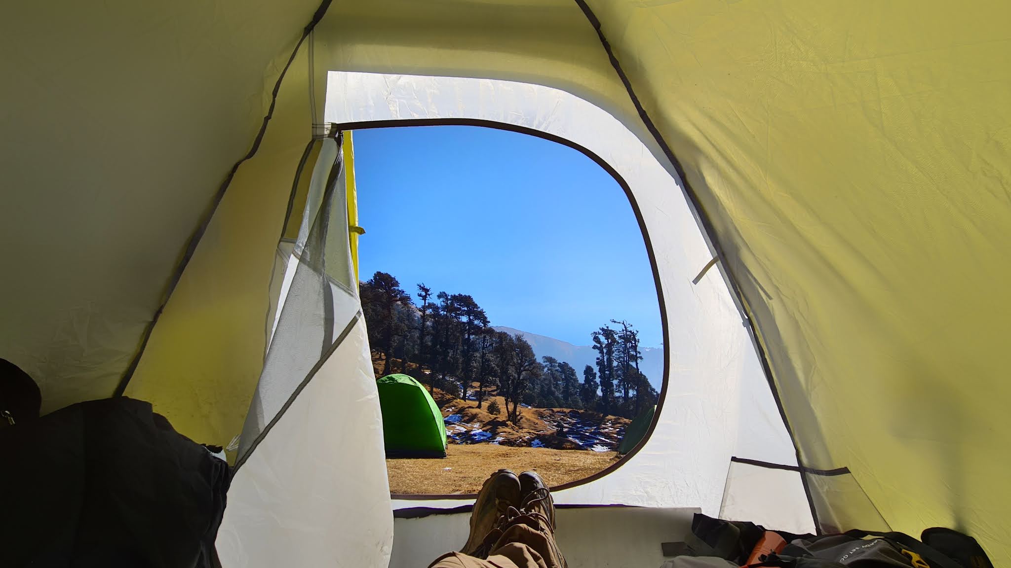
of oaks and rhododendrons to snow-covered meadows, lakeside camping at Bekaltal,
the alpine Brahmatal lake vicinity. A special shout out for this trek goes to the shutterbugs—diverse frames, from snow-
laden forests to white-gold high peaks in alpenglow, and a desolate alpine mountain-
scape of a lone tree standing on icy shores of the Brahmatal lake make up the
composition of this trek.
Best Time to Trek: Winter (December –February) -
It is considered as the perfect
destination for winter trekking as you will be able to witness the
frozen lakes which are so thrilling and captivating snow capped peaks.
Day 1:- Lohajung to Bekaltal
The first day’s trek spanning 5 hours will kick off from Lohajung up a snaky trail going into the forest. After a short while the forest will give way to a small village named Mandoli to your left. Here you can fill your bottles and take a first major hiatus. The trail continues in mostly gradual ascent curves. A little way higher, you will come across the valley where two mountain rivers Kali and Pindari confluence. This is the Kali valley, lying in a splendid green scrap even in the midst of wintry heights. We will trek on further to stumble upon a huddle of mud huts. You are going to find a grove of rhododendron here that sure grows red and heavy from February to March, but at the peak of winter, the trail will be pretty matte. Crossing this point, trek on to find the next identifiable landmark—a wooden bridge over a stream.
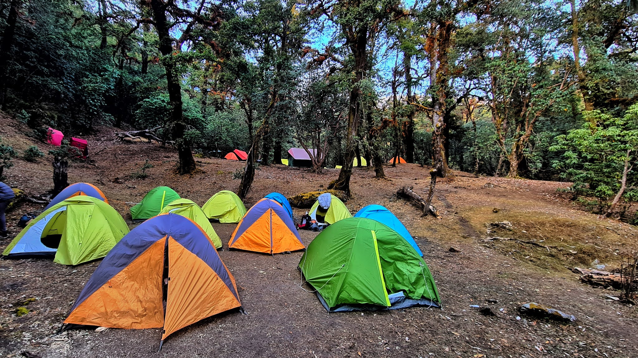
This steam is a viable water point which you can access going down the slope. Crossing over on to the other side, you will reach Begum—a nestling rest point on the slopes overlooking a vast expanse of bugyals at distance. From here, the path bends on to two more chattering streams, the last being Gujrani stream. Take approximately an hour’s hike after crossing the last stream to reach the beautiful Bekaltal gleaming peacefully in the summer while partially frozen over in the winters. Camped in the vicinity by the lake Khopdaliya. Enjoy the stillness and the quiet of this place with the thick oak forests closing in from around.
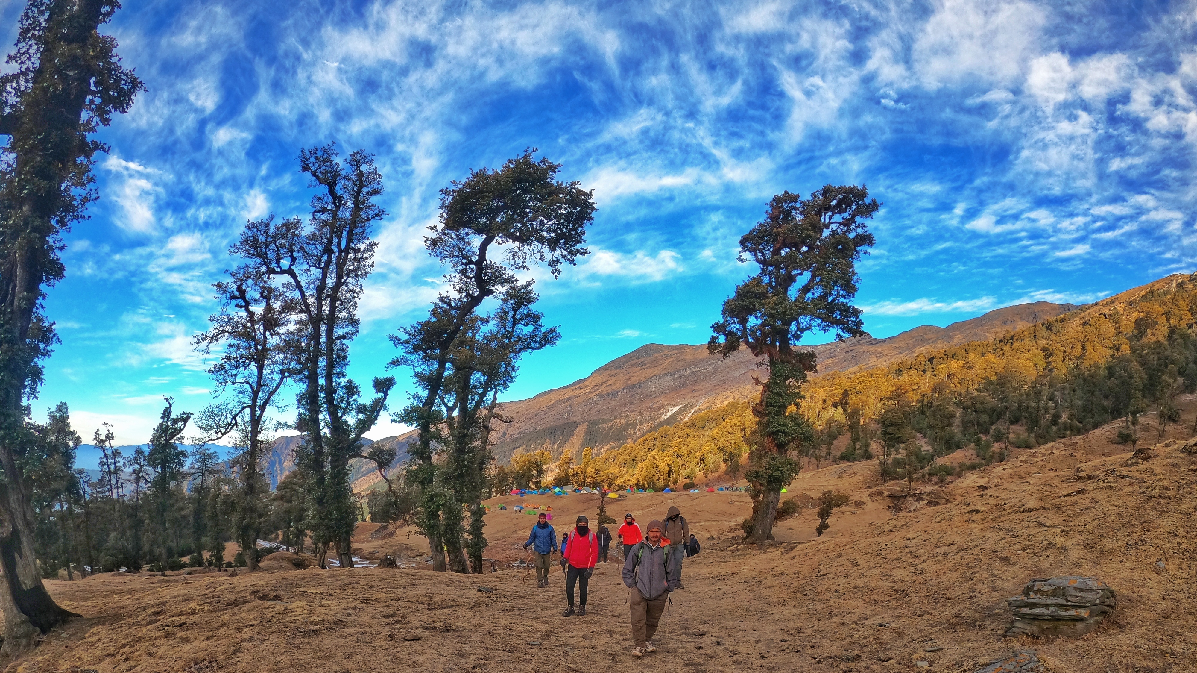
Day 2:- Bekaltal to Brahmatal
Today’s trek will take you through thickets of oaks and rhododendrons over steepslopes for quite some time before finally coming out to a meadow. This is the meadow of Telandi. In the winter, you will find the green expanse of Telandi transform into a vast snowfield and crossing the area, a gala of thrill.
The meadow rolls till 11,500 ft.- the highest point, from where begins a slow descent to Brahmatal. To your left from here, you will find a small temple, bright yellow flags flying in the air. Walk down the slope to the temple and find the trail winding towards the Brahmatal Lake, about 500 meters away from the temple now. We will find the valleys of Almora and Nainital rise and fall around us as we go. The soaring peaks of Trishul, Nanda Ghunti, and others of the Greater Himalayas can be spotted far across the sky. We will be camping at the mark 500 meter away from the lake, nestling in the beautiful aura of the place.
Note: Make sure to carry 2-3 litres of water on today’s trek since there are no water points on this trail.
Day 3:- Brahmatal to Brahmatal high point and back
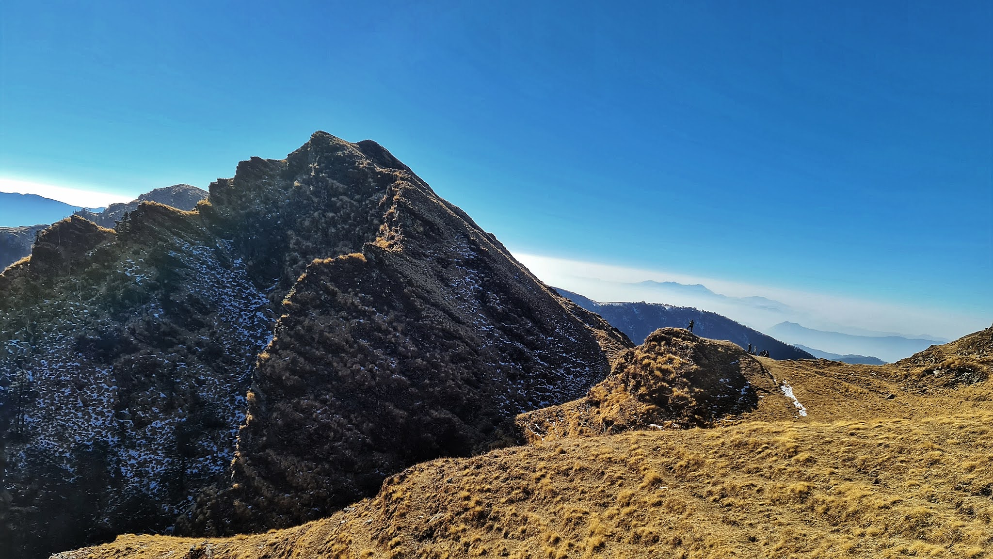
The visual treat of the high peaks is going to intensify today, opening up a view from the 12,100 feet summit of Brahmatal. We will cross the lake and go higher up through the depths of a hushed forest. Where the forest hike ends, a panorama of stunning ice peaks opens up. At the first 180 degrees to your left you can spot Chaukhamba, Mandir, Mana, Nilgiri, Neelkanth, Trishul, Nanda Ghunti, and Maitoli peaks. At the furthest horizon, the Panchachuli ranges will unveil, as will a great expanse of the lower Shivalik stretches, equally snow filled and white as the higher visible zones.
Bask in the glorious sight and come back to camp.
Note: Carry 2-3 litre water, there will be no water points available.
Day 4:- Brahmatal to Lohajung
Wake up and gear for a long winded descent from Brahmatal to Lohajung- a 9 km trek likely to span 7-8 hours. or those new or unpracticed to trekking, knee-pads and walking sticks are a must. The long hike down can really take the life out of your legs if hitting on the rocky ledges hidden under snow is constant.
Our first route will break towards Lohajung after reaching the point Khabekhal. Post this point, the trail will go into a beatific tree surrounded location. This place is Daldum. A 20-30 minutes more into the trek, we will be reaching Malling. This is just outside a fringe of forests and equipped with water sources. A cluster of locality can be seen down below from Daldum. Hiking down ahead, we will reach an expansive farming ground. This is an agricultural land growing potatoes and other crops in summer. Winter renders the place quite desolate, save a few houses on the brink. A paved stone trail shows the way towards Lohajung from here- another hour’s trek on the descent.
 |
| Trishul Peak |


| ||||||||||||||||||


I just need to say this is a well-informed article which you have shared here about hoodies. It is an engaging and gainful article for us. Continue imparting this sort of info, Thanks to you. Camping Newport Oregon
ReplyDelete